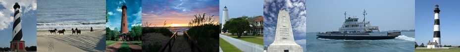
Hatteras Island
After crossing the Herbert C. Bonner Bridge heading south lies Hatteras Island. A beautiful island that’s about 42 miles long and at its widest parts only about 1 mile wide. The island is so narrow in some areas Highway 12 is just a few hundred feet from the waters of the Pamlico Sound and from the Atlantic Ocean surf. During bad storms or hurricanes the highway is covered by water and or sand. Hatteras is known as “the blue marlin capitol of the world” and is a great place to fish. There are several marinas located on the island. Taking a charter boat out for marlin, dolphin and red drum is a big business on the island. Due to an almost always blowing wind the island is very popular for the sport of windsurfing and kite boarding. Surfing is another popular activity. Cape Hatteras Beaches are frequently listed on the Top 10 Beaches List.

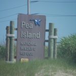
The first stop heading south from Oregon Inlet on Hatteras Island is the Pea Island National Wildlife Refuge. A 13 mile long eco-
The Tri-villages of Rodanthe, Waves and Salvo
The first of 7 villages located on Hatteras Island that visitors reach heading south on Highway 12 is Rodanthe. Actually 3 villages make up the “tri-
Also in Rodanthe is the house used for the filming of the 2008 movie “Nights in Rodanthe” based on the book of the same name written by Nicholas Sparks. The house used to be the first oceanside house on the left as you enter Rodanthe on Highway 12. After being repeatedly damaged by ocean waves and flooding during storms the house was bought and the new owners moved the house (to prevent demolition). In the new location just down the road it sits oceanside but at a much safer distance and not as easy to see from the highway.
The first fishing pier on the island is located in Rodanthe. The Hatteras Island Fishing Pier is one of 3 fishing piers-
Rodanthe, Waves and Salvo have rental homes, shops, restaurants and lots of water related sports activities such as kite boarding, windsurfing and surfing.
Avon
After the Tri-villages the next village is Avon. The largest commercially of the 7 villages located on the entire island, Avon has the only major chain grocery store on Hatteras Island. First known as “Kinnakeet” this area grew up from 2 life saving stations located in the area. The crew and their families settled the community. Avon is now the most developed village on the island with restaurants, rental houses, shopping and a fishing pier.
The Avon Pier is 600 feet long and holds the World All-
Canadian Hole Area
After leaving Avon and before reaching the next village of Buxton is a well known area for kite boarding and windsurfing is Canadian Hole. It is located on the sound side of Highway 12. The haul-
The area can become very crowded so get there earlier.It’s a great place to enjoy the sport or just watch all the fun. It’s also a great location to take a sunset picture each evening as the sun sinks into the Pamlico Sound.
Buxton

A quick drive further south on Highway 12 takes you into Buxton. The Cape Hatteras Lighthouse is located in Buxton. Climbing the lighthouse is a must while in Buxton. Nearby is Cape Point. Cape Point is world famous for great surf fishing. “The Point” is where the beach comes to a point close to the nearby warm waters of the Gulf Stream. Game fish migrating up and down the coast via the Gulf Stream can be caught. Fishing the point can result in reeling in Spanish mackerel, king mackerel, pompano, bluefish, red drum, mahi mahi, cobia and flounder plus shark and skat.
On the quieter side south of Cape Point is South Beach. The ocean meets the beach is gentle waves and the area is great for beach combing. After storms this is the place to find a variety of shells washed up onshore.
Diamonds Shoals are located off the coast of Buxton. The cold waters of the Labrador Current and the warm waters of the Gulf Stream current create rough waters and dangerous sandbars off the coast. Many shipwrecks have occurred off the N.C. coast in this area.
Frisco
After Buxton is the village of Frisco. Once called “Trent”. This area of Hatteras Island was where a large number of Native American Indians lived. Part of the Algonquin tribe, the Croatan Indians lived on the island. By the late 1700’s they tribe was no longer present. The Frisco Native Museum has many local artifacts found on the island on display.
The beaches of Frisco are perfect for families that want a day on the beach. The ocean waves are usually calm and the bottom is nice and sandy. It’s a great place for the kids to play in the ocean. The Scotch Bonnet Marina on the sound side has sound access for boaters and the Scotch Bonnet is the place to buy fudge made fresh daily in many different flavors.
Along Highway 12 visitors see signs about stables that offer horseback riding along the beach. There are also several tackle and bait shops for the fisherman. The Billy Mitchell Airstrip is located in Frisco and just past the airstrip is Ramp 49. This is a great beach if you have an ORV to enjoy a day at the ocean. The island also has the only airport (other than the Manteo Airport on Roanoke Island) on the Outer Banks.
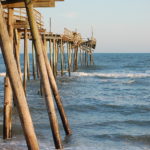
The Frisco Pier located on Frisco was victim to a Hurricane Earl in 2010. It still stands but was heavily damaged. The pier house still stands and the area is a local landmark and a good surf fishing spot.
Hatteras Village
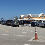
At the southern end of the island lies Hatteras Village. The main focus of Hatteras is fishing. Several marinas are located here with charter boats that take visitors out thru Hatteras Inlet to the Gulf Stream just 15 miles off the coast. In 1962 a 810 pound blue marlin was caught off the coast earning Hatteras the title Blue Marlin Fishing Capital of the World. Each afternoon when the charter boats return to the marinas crowds gather at the docks to see the catches unloaded. Catches of wahoo, yellowfin tuna, dolphin, cobia, red drum, blue marlin, white marlin, snapper and other species are common.
There are lots of shops, galleries, restaurants, coffee shops and beach supply stores along the highway. Hatteras has an historic village community with quaint old houses that once made up the fishing village. The library is located next to the church and the rescue squad in the bend of the road just before reaching the local Red and White grocery store.
The paved highway nears an end at Hatteras Landing. A shopping center painted in multi-
Map of Hatteras Island
